


Payne, Seminole, Creek (Southwest), Hughes & Okfuskee Counties--Stillwater City PUMA, Oklahoma
About
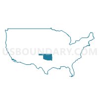
Outline
%2c+Hughes+%26+Okfuskee+Counties--Stillwater+City+PUMA%2c+Oklahoma_A280.png)
Summary
| Unique Area Identifier | 193804 |
| Name | Payne, Seminole, Creek (Southwest), Hughes & Okfuskee Counties--Stillwater City PUMA |
| State | Oklahoma |
| Area (square miles) | 3,399.01 |
| Land Area (square miles) | 3,350.73 |
| Water Area (square miles) | 48.28 |
| % of Land Area | 98.58 |
| % of Water Area | 1.42 |
| Latitude of the Internal Point | 35.51035240 |
| Longtitude of the Internal Point | -96.51476970 |
Maps
%2c+Hughes+%26+Okfuskee+Counties--Stillwater+City+PUMA in Oklahoma.png)
Graphs
Select a template below for downloading or customizing gragh for Payne, Seminole, Creek (Southwest), Hughes & Okfuskee Counties--Stillwater City PUMA, Oklahoma
%2c+Hughes+%26+Okfuskee+Counties--Stillwater+City+PUMA%2c+Oklahoma_T0.png)
%2c+Hughes+%26+Okfuskee+Counties--Stillwater+City+PUMA%2c+Oklahoma_T1.png)
%2c+Hughes+%26+Okfuskee+Counties--Stillwater+City+PUMA%2c+Oklahoma_T2.png)
%2c+Hughes+%26+Okfuskee+Counties--Stillwater+City+PUMA%2c+Oklahoma_T3.png)
%2c+Hughes+%26+Okfuskee+Counties--Stillwater+City+PUMA%2c+Oklahoma_T4.png)
%2c+Hughes+%26+Okfuskee+Counties--Stillwater+City+PUMA%2c+Oklahoma_T5.png)
%2c+Hughes+%26+Okfuskee+Counties--Stillwater+City+PUMA%2c+Oklahoma_T6.png)
%2c+Hughes+%26+Okfuskee+Counties--Stillwater+City+PUMA%2c+Oklahoma_T7.png)
%2c+Hughes+%26+Okfuskee+Counties--Stillwater+City+PUMA%2c+Oklahoma.png)
Neighbors
Neighoring Public Use Microdata Area (by Name) Neighboring Public Use Microdata Area on the Map
- Bryan, Pontotoc (East), Marshall, Atoka, Johnston & Coal Counties--Ada City PUMA, OK
- Carter, Garvin, Murray, Love & Pontotoc (West) Counties PUMA, OK
- Garfield, Kay & Noble Counties--Enid City PUMA, OK
- Grady, McClain & Pottawatomie (South) Counties PUMA, OK
- Muskogee, Okmulgee, Wagoner (East) & McIntosh Counties PUMA, OK
- Pottawatomie (North), Logan & Lincoln Counties--Shawnee City PUMA, OK
- Southeast Oklahoma PUMA, OK
- Tulsa (West), Creek (Northeast) & Osage (Southeast) Counties--Tulsa City (West) PUMA, OK
- Washington, Osage (North & West), Pawnee & Creek (Northwest) Counties PUMA, OK
Top 10 Neighboring County (by Population) Neighboring County on the Map
- Payne County, OK (77,350)
- Creek County, OK (69,967)
- Pottawatomie County, OK (69,442)
- Pittsburg County, OK (45,837)
- Logan County, OK (41,848)
- Okmulgee County, OK (40,069)
- Pontotoc County, OK (37,492)
- Lincoln County, OK (34,273)
- Seminole County, OK (25,482)
- McIntosh County, OK (20,252)
Top 10 Neighboring County Subdivision (by Population) Neighboring County Subdivision on the Map
- Shawnee CCD, Pottawatomie County, OK (64,590)
- Stillwater CCD, Payne County, OK (63,113)
- Sapulpa CCD, Creek County, OK (37,551)
- Guthrie CCD, Logan County, OK (32,848)
- Okmulgee CCD, Okmulgee County, OK (17,935)
- Seminole North CCD, Seminole County, OK (12,428)
- Keystone Lake CCD, Creek County, OK (11,791)
- Cushing CCD, Payne County, OK (11,784)
- Cleveland CCD, Pawnee County, OK (11,379)
- Henryetta CCD, Okmulgee County, OK (11,055)
Top 10 Neighboring Place (by Population) Neighboring Place on the Map
- Stillwater city, OK (45,688)
- Sapulpa city, OK (20,544)
- Cushing city, OK (7,826)
- Seminole city, OK (7,488)
- Holdenville city, OK (5,771)
- Bristow city, OK (4,222)
- Wewoka city, OK (3,430)
- Okemah city, OK (3,223)
- Drumright city, OK (2,907)
- Perkins city, OK (2,831)
Top 10 Neighboring Elementary School District (by Population) Neighboring Elementary School District on the Map
- Jennings Public School, OK (1,016)
- Gypsy Public School, OK (745)
- Oak Grove Public School, OK (723)
- Bearden Public School, OK (533)
- Milfay Public School, OK (524)
- Justice Public School, OK (312)
- Ryal Public School, OK (303)
Top 10 Neighboring Unified School District (by Population) Neighboring Unified School District on the Map
- Stillwater Public Schools, OK (51,774)
- Guthrie Public Schools, OK (22,755)
- Okmulgee Public Schools, OK (14,308)
- Cushing Public Schools, OK (10,059)
- Bristow Public Schools, OK (8,777)
- Byng Public Schools, OK (8,550)
- Perkins-Tryon Public Schools, OK (7,744)
- Seminole Public Schools, OK (7,567)
- Holdenville Public Schools, OK (7,437)
- Henryetta Public Schools, OK (7,282)
Top 10 Neighboring State Legislative District Lower Chamber (by Population) Neighboring State Legislative District Lower Chamber on the Map
- State House District 31, OK (44,222)
- State House District 34, OK (39,285)
- State House District 33, OK (37,766)
- State House District 30, OK (37,080)
- State House District 27, OK (36,934)
- State House District 17, OK (36,307)
- State House District 35, OK (36,242)
- State House District 25, OK (36,224)
- State House District 32, OK (36,057)
- State House District 29, OK (35,727)
Top 10 Neighboring State Legislative District Upper Chamber (by Population) Neighboring State Legislative District Upper Chamber on the Map
- State Senate District 21, OK (81,344)
- State Senate District 19, OK (77,948)
- State Senate District 10, OK (76,617)
- State Senate District 28, OK (76,209)
- State Senate District 8, OK (75,663)
- State Senate District 17, OK (74,685)
- State Senate District 12, OK (74,360)
- State Senate District 7, OK (73,650)
- State Senate District 13, OK (73,191)
- State Senate District 20, OK (68,510)
Top 10 Neighboring 111th Congressional District (by Population) Neighboring 111th Congressional District on the Map
- Congressional District 4, OK (785,424)
- Congressional District 1, OK (754,310)
- Congressional District 5, OK (749,336)
- Congressional District 3, OK (732,394)
- Congressional District 2, OK (729,887)
Top 10 Neighboring Census Tract (by Population) Neighboring Census Tract on the Map
- Census Tract 109, Payne County, OK (8,266)
- Census Tract 5011.02, Pottawatomie County, OK (7,907)
- Census Tract 6005, Logan County, OK (7,281)
- Census Tract 6, Okmulgee County, OK (7,200)
- Census Tract 5009, Pottawatomie County, OK (6,881)
- Census Tract 104, Payne County, OK (6,372)
- Census Tract 111.02, Payne County, OK (6,246)
- Census Tract 110, Payne County, OK (5,735)
- Census Tract 206.01, Creek County, OK (5,643)
- Census Tract 5011.01, Pottawatomie County, OK (5,520)
Top 10 Neighboring 5-Digit ZIP Code Tabulation Area (by Population) Neighboring 5-Digit ZIP Code Tabulation Area on the Map
- 74066, OK (31,060)
- 74820, OK (30,802)
- 74074, OK (29,184)
- 74501, OK (29,073)
- 74075, OK (23,866)
- 73044, OK (20,226)
- 74804, OK (19,631)
- 74447, OK (17,275)
- 74868, OK (13,152)
- 74873, OK (11,821)